Tag Archives: mapping
UM-Flint professor uses GIS to research foraging in Detroit

If the Earth's population exceeds its carrying capacity during the next 100 years, one of the most important questions will be how to support the food needs of the planet. Greg Rybarczyk, associate professor of geography at the University of Michigan-Flint, is currently investigating that query by researching an often overlooked food resource: edible natural[…]
UM-Flint's Geographic Information Systems (GIS) Day: Seeing the World from New Perspectives
GIS Day is a grassroots event that serves to promote and increase access to the powerful tools available through the new UM-Flint Geographic Information Systems Center (GISC), including analysis techniques, cartography, and geospatial technology.
University of Michigan-Flint to Open Geographic Information Systems Center
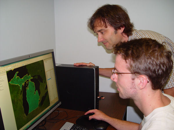
Geographic Information Systems consist of computer software programs capable of inputting, displaying, and analyzing any data with location information, and the means to produce maps from those data.