UM-Flint professor uses GIS to research foraging in Detroit
If the Earth's population exceeds its carrying capacity during the next 100 years, one of the most important questions will be how to support the food needs of the planet.
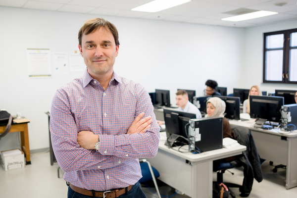
Greg Rybarczyk, associate professor of geography at the University of Michigan-Flint, is currently investigating that query by researching an often overlooked food resource: edible natural food plantings. To date, the majority of researchers investigating food access have focused on large-scale supermarkets, community gardens and fast-food restaurants. Rybarczyk however has turned his attention to bridging the gap between comprehensive food providers and the public. "In food access research, little attention has been paid to urban foraging behavior and that is something that should be more thoroughly examined as an option," Rybarczyk said.
Rybarczyk is currently using geographic information systems and advanced spatial analysis techniques to help explain where people are currently foraging edible foods, and how to promote this in other Detroit neighborhoods to help people meet their daily healthy food needs. The results of this research may improve the understanding of ways to reduce food insecurity in marginalized neighborhoods. "One of the pressing concerns, as our population grows, is whether or not those in densely-populated urban areas, like Detroit, will be able to source and provide healthy food in the future, which ultimately affects the quality of life."
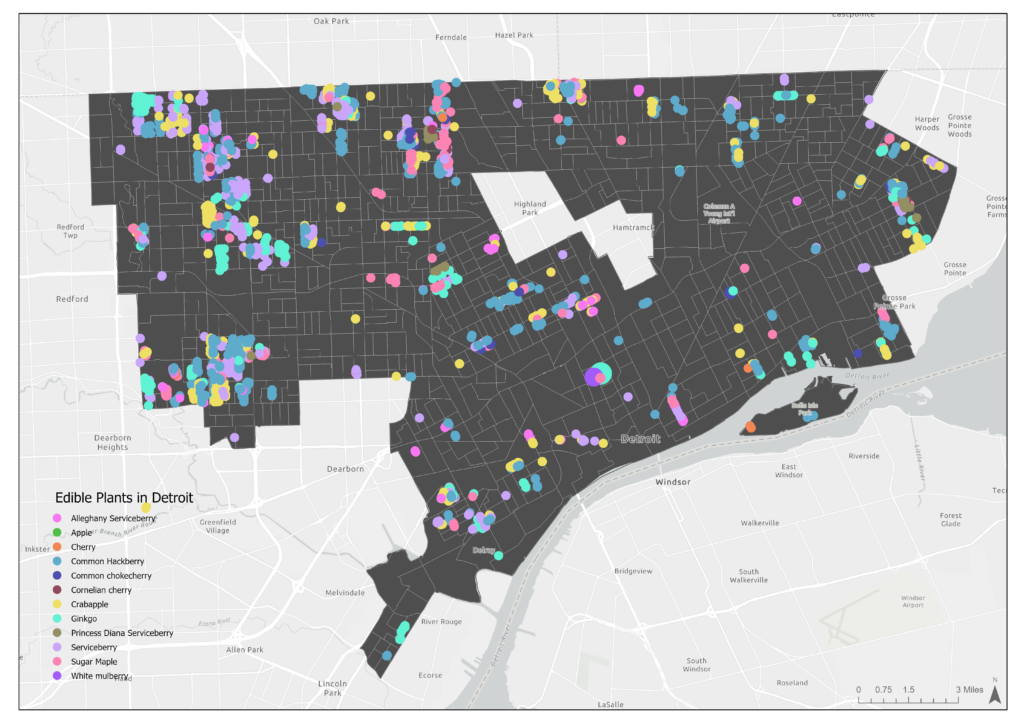
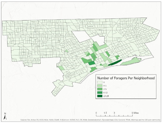
Rybarczyk was able to utilize funding from the Office of Research and Economic Development to obtain some "bikeability and walkability" data for Detroit. With the help of Marlena Janda, a 2020 UM-Flint graduate with a bachelor's degree in environmental science, he has combined that information with data that shows localized socioeconomic status, demographics, where plant resources and edible trees are located in the city, and where in the city people are foraging.
Surprisingly, Rybarczyk and Janda have identified that GIS "hot-spots" of edible plants and trees don't match where this activity is happening. They also found that people tended to forage more actively in neighborhoods with a higher perception of bikeability and walkability. "Existing research points to biophilic design – design of our built environment to focus on aspects of the natural world that contribute to human health and productivity – as having mood, psychosocial, and overall health benefits," Rybarczyk said.
For the next phase of the project, Rybarczyk plans to access public health data from the Centers for Disease Control and Prevention's National Health and Nutrition Examination Survey on Detroit and urban design indicators. He has also hired an intern to use ArcGIS Pro software to assemble publicly available geospatial datasets.
"Currently, we have a limited spatial understanding on how urban design, food access, and human health are linked. Through the application of spatial modeling and geospatial technology, we will highlight new insights to help planners and policy-makers consider natural urban edible food resources to alleviate food insecurity in Detroit," Rybarczyk said.
UM-Flint News
The Office of Marketing & Communications can be reached at mac-flint@umich.edu.