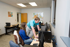
UM-Flint's Geographic Information Systems (GIS) Day: Seeing the World from New Perspectives

It's not a holiday, but it is a special day and the Department of Earth and Resource Science (ERS) invites you to learn more about geographic information systems (GIS) and the new UM-Flint Geographic Information Systems Center (GISC) on November 20.

GIS Day is a grassroots event that serves to promote and increase access to the powerful tools available in the GISC, including analysis techniques, cartography, and geospatial technology.
Join keynote speaker Flint Mayor Dayne Walling, UM-Flint faculty, staff, and students, as well as industry professionals, non-profit representatives, and public sector employees to see how GIS technology can be applied across a wide spectrum of possibilities.
GIS Day schedule:

9:00 a.m. | Murchie Science Building, Room 520
Registration/Coffee – Introduction to UM-Flint, Department of Earth and Resource Science, and the GIS Center.
10:00 a.m. | 507 Murchie Science Building
Workshop: Getting to know GIS | Troy Rosencrants, GIS Center (GISC) Manager
Learn basic ArcMap, ArcExplorer, and ArcGIS Online functions to create off-line and online maps using localized spatial data
11:00 a.m. | Murchie Science Building, Room 513B
GISC Tour and Introductions
12:00 p.m. | Harding Mott University Center KIVA (first floor)
Lunch (provided by Department of Earth and Resource Science)
Keynote Speaker: Flint Mayor Dayne Walling – "Geography and GIS in the New Flint Master Plan?"
1:00 p.m. | 507 Murchie Science Building
Workshop: Getting from Here to There: Using GIS for Transportation Analysis | Dr. Greg Rybarczyk, GISC Director
2:00 p.m. |
GIS Day Wrap-Up
The conference is free, but due to space limitations, registration is required at http://www.umflint.edu/gis/gis-day-registration.
Related Posts
No related photos.
UM-Flint News
The Office of Marketing & Communications can be reached at mac-flint@umich.edu.